START HERE
Why visit Zion National Park
Zion National Park compresses towering sandstone walls, riverside paths, exposed ridges, and high-country drives into a relatively small area with very concentrated demand. It suits hikers, photographers, families, road trippers, and first-time U.S. national-park visitors, but the right itinerary depends on season, mobility, water conditions, and tolerance for exposure. Two days cover Zion Canyon highlights; three or four allow a quieter trail, Kolob Canyons, and weather flexibility. This guide explains the shuttle system, arrival routes, Springdale lodging, trail selection, permits, realistic costs, and a route that avoids wasting hours on parking. The main fact to understand is that Zion Canyon changes operating mode through the year: during shuttle season, private vehicles generally cannot use the Scenic Drive, while specific hikes, including Angels Landing beyond Scout Lookout, may require separate permits.
AT A GLANCE
Zion National Park quick travel summary
Zion National Park budgets below are planning ranges, not quotes. Shuttle seasons, vehicle-access rules, Springdale room demand, and permit terms can change the total, so confirm current details before booking.
WHEN TO GO
Best time to visit
Spring (March–May)
Spring brings mild canyon temperatures, wildflowers, high river flow, and large crowds. Snow can remain on higher routes while runoff may close or complicate The Narrows. Accommodation prices rise and shuttle queues grow. Use layers, begin early, and check trail, water, and flash-flood conditions instead of assuming every famous hike is available.
Summer (June–September)
Summer is hot, crowded, and within monsoon season. Exposed trails can become dangerous by midday, while slot canyons and river routes carry flash-flood risk. Park and Springdale lodging are expensive. Take the first practical shuttle, carry substantial water, avoid exposed afternoon hiking, and keep one non-canyon alternative for storm days.
Fall (October–November)
Fall usually offers cooler hiking weather, changing cottonwoods, and lower river levels, although crowds remain strong in October. Night temperatures drop quickly and shuttle operation changes later in the season. This is an excellent time for Emerald Pools, Watchman-area walks, and east-side scenery. Reserve lodging and verify the last shuttle.
Winter (December–February)
Winter is quiet, cold, and visually dramatic after snow. Private vehicles may be allowed on the Scenic Drive during periods without shuttle service, but ice, short daylight, and reduced services alter the trip. Bring traction and warm layers, never park beyond designated areas, and avoid exposed routes when snow or ice makes footing uncertain.
ARRIVING
How to get there
Harry Reid International Airport in Las Vegas is the most common major gateway, followed by a drive of about three hours under normal conditions. St. George Regional Airport is closer but has fewer flights. Drivers should account for the time-zone change when traveling between Nevada and Utah, confirm rental terms, and avoid arriving after dark if unfamiliar with rural roads. Springdale sits at the south entrance and is the easiest visitor base. The east entrance connects with U.S. 89 and other Utah parks through the Zion–Mount Carmel Highway, where large vehicles face tunnel rules and traffic delays. There is no direct passenger rail service. Limited commercial shuttles connect regional hubs, but reservations and onward movement must be planned. Check road conditions, park alerts, and fuel before leaving major towns.
MOVING AROUND
Getting around
During most of the visitor season, the free Zion Canyon shuttle is the main way to reach trailheads along the Scenic Drive; no ticket or reservation is normally needed for the standard park shuttle, but the park entrance fee still applies. Private vehicles generally cannot use the Scenic Drive while shuttles operate. The separate Springdale shuttle helps travelers reach the pedestrian entrance from town. Lines can be long at the visitor center, so staying near a Springdale stop and boarding early is valuable. A car remains useful for the east side, Kolob Canyons, and travel between parks. Cycling the Scenic Drive is possible for experienced riders who follow shuttle-safety rules. Travelers requiring accessible service should consult NPS guidance for specific stops, lifts, and trails.
CHOOSE A BASE
Where to stay
Springdale — best for first-time visitors
Springdale provides restaurants, shuttle stops, gear services, and quick access to the pedestrian entrance. It minimizes parking stress and suits short trips without much night driving. Rooms are expensive in peak season and sell early. Check whether parking is included and how far the property is from a shuttle stop.
Inside Zion National Park — best for early access
The park lodge places guests inside the canyon and reduces some daily transport. It suits travelers prioritizing sunrise, short walks, and a focused park stay. Availability is limited, prices can be high, food choices are fewer, and lodging does not remove the need to follow shuttle and trail rules.
Hurricane, La Verkin, or St. George — best for budget and road trips
These towns offer a wider accommodation range and useful positions for regional routes. They work for drivers and longer stays. The trade-off is an early commute, entrance traffic, and parking uncertainty. A lower room rate may not compensate for daily time lost on the road.
PLAN YOUR DAYS
Best things to do
Zion Canyon and Riverside Walk
The shuttle journey reveals the canyon’s scale, while Riverside Walk provides a relatively accessible approach toward The Narrows. Allow two to three hours for the walk and stops, excluding shuttle queues. Begin early or later in the day. The paved trail can still have wet surfaces, drop-offs, and crowding. Continuing into the river requires separate preparation and current condition assessment.
The Narrows
The bottom-up Narrows route involves walking in the Virgin River over uneven stones, with cold water, strong current, and flash-flood exposure. Duration ranges from a short sample to most of a day. No permit is generally required for the standard bottom-up day hike, but conditions can close it. Rent appropriate gear when useful, check NPS forecasts, and never enter under uncertain flood risk.
Angels Landing and Scout Lookout
The West Rim Trail to Scout Lookout is strenuous; the chained Angels Landing section adds extreme exposure and requires the current permit. Allow four to six hours depending on destination and queues. Apply only through official systems, carry water, and skip the chains in ice, high wind, storms, or discomfort. Scout Lookout remains a significant hike without the final section.
Emerald Pools or Watchman Trail
These trails provide more flexible alternatives. Emerald Pools vary with water, closures, and bridge access; Watchman offers open views near the visitor center. Allow two to four hours. Start early in heat, stay behind barriers, and expect slippery rock near water. They suit travelers who want a substantial experience without river hiking or Angels Landing exposure.
East Zion and Canyon Overlook
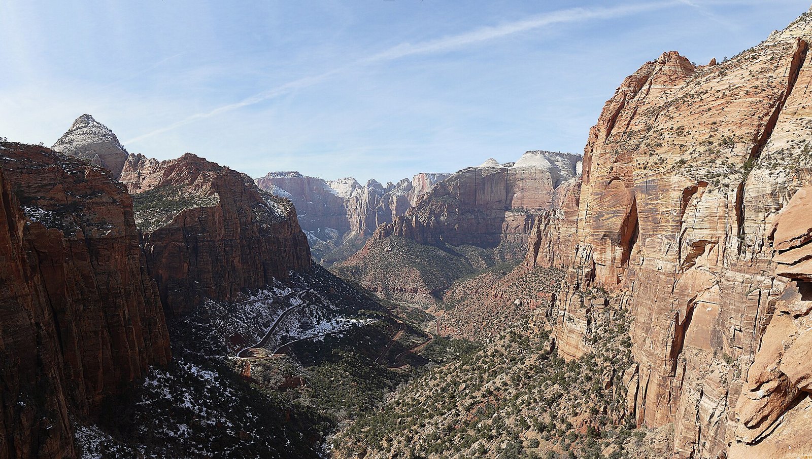
The Mount Carmel Highway, Checkerboard Mesa, and east-side landscapes show a different geology. Canyon Overlook is short but includes drop-offs and extremely limited parking. Visit early, use only legal pullouts, and do not walk along the highway from an unsafe space. Combine the east side with an onward road trip rather than crossing the park repeatedly.
A PRACTICAL ROUTE
Suggested itinerary
Canyon orientation
Enter early, take the shuttle to Riverside Walk, and stop selectively on the return. Finish with Pa’rus Trail or a Springdale evening instead of adding a distant drive.
Choose one major hike
Complete The Narrows, Scout Lookout, or a permit-backed Angels Landing plan according to conditions and ability. Do not combine technical or exhausting routes merely to fill a checklist.
Flexible trails and east side
Use Emerald Pools or Watchman in the morning, then drive the east side when traffic and daylight are suitable. Check tunnel and parking notices.
Kolob or weather recovery
Visit Kolob Canyons if roads are open, choose a ranger program, or repeat a gentler canyon walk. Keep the day flexible for heat, storms, or trail closures.
REALISTIC BUDGET
Estimated travel costs
USD equivalents for Zion National Park are rounded planning comparisons where shown. For Zion National Park, check local tax, gratuity, accommodation fees, and cancellation terms before payment.
TRAVEL WELL
Practical travel tips
- Check the NPS shuttle page rather than using last year’s schedule. Operating dates and final departures change through the season.
- An Angels Landing permit covers only the permitted section; it does not guarantee suitable weather, fitness, or a safe decision to continue.
- Flash floods can occur even when rain is distant. Never enter The Narrows or a slot canyon when official forecasts indicate concern.
- Carry more water than an ordinary city walk requires and use electrolytes in heat. There is limited shade on many exposed routes.
- Board the canyon shuttle early and know the last return time. Missing it creates a serious transport problem, not a minor delay.
- Parking outside official areas damages vegetation and can block emergency access. Use Springdale transit or return later when lots are full.
- Cell service is unreliable. Save maps, permits, and emergency information offline before entering the canyon.
- Solo female hikers should share the route and turnaround time, choose well-used trails within ability, and avoid relying on a stranger for river or exposed-route safety.
COMMON QUESTIONS
Zion National Park travel FAQ
How many days do you need in Zion National Park?
Two days cover Zion Canyon and one major hike. Three or four days add the east side, quieter routes, and flexibility for heat, storms, or closures.
Do you need a reservation to enter Zion?
A general entry reservation is not normally required, but the entrance fee applies and certain activities—most notably Angels Landing beyond Scout Lookout—use separate permits.
Is the Zion shuttle free?
The standard Zion Canyon and Springdale shuttle systems are generally free. Park admission is separate, and special commercial transport or guided services may charge.
Can you drive into Zion Canyon?
During shuttle season, private vehicles generally cannot use the Zion Canyon Scenic Drive. Outside shuttle operation, access rules differ and can change with conditions.
What is the best month to visit Zion?
April, May, October, and early November offer comfortable hiking conditions, but crowds remain strong. River flow, heat, and ice affect which routes are suitable.
Is Zion suitable for non-hikers?
Yes. Shuttle viewpoints, Pa’rus Trail, scenic drives, ranger programs, and short walks provide strong experiences without technical hiking, subject to accessibility and weather.
KEEP EXPLORING
Related The Wander Muse guides
CHECK BEFORE DEPARTURE
Sources and official resources
Schedules, fares, closures, and timed-entry systems affecting Zion National Park can change. Recheck the official resources below shortly before departure.