Waterfall valleys and immaculate rail journeys

Swiss Alps Travel Guide: Lauterbrunnen Itinerary, Costs & Tips

Cable-car villages, glacier views, turquoise lakes, and trains that turn transfers into the experience.

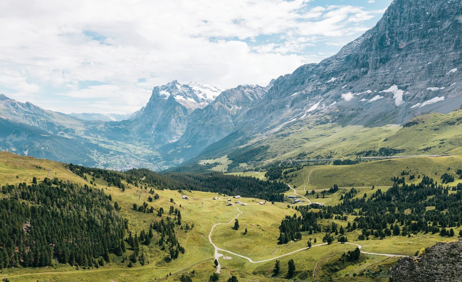
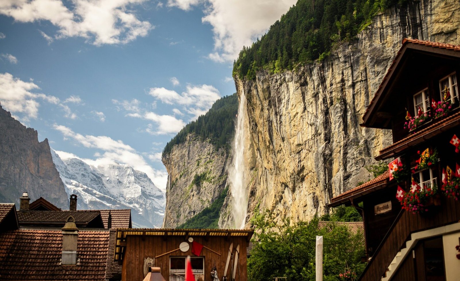
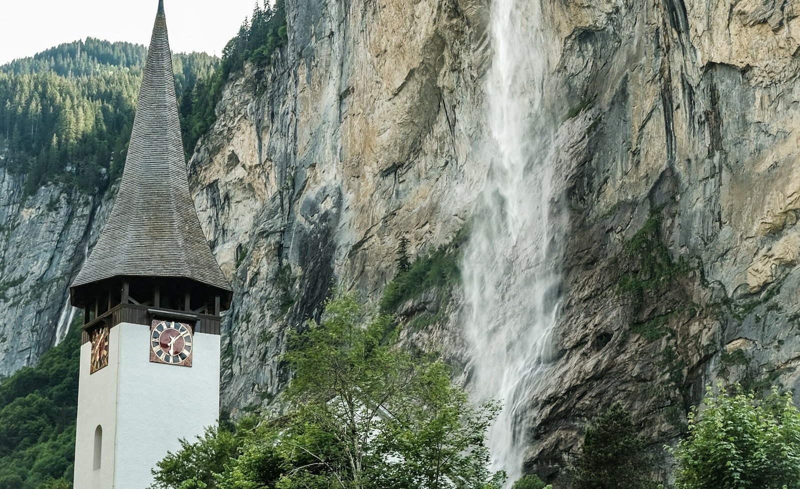
The green Lauterbrunnen Valley beneath the Swiss Alps
· Source ↗

START HERE

Why visit Swiss Alps

The Lauterbrunnen region concentrates waterfalls, car-free mountain villages, lake connections, and some of Switzerland’s most efficient scenic rail journeys. It suits mountain scenery, train travel, hiking, couples, families, and car-free itineraries and works best when Lauterbrunnen Valley walk and Mürren and the Northface Trail stay on separate compact days. A first visit works best when Lauterbrunnen Valley walk, Mürren and the Northface Trail, and Wengen and Kleine Scheidegg are arranged around realistic transport and weather windows. Lauterbrunnen is the transport hub, Mürren provides dramatic quiet on the west side, and Wengen places classic mountain hotels above the opposite slope. Swiss Alps planning connects Interlaken Ost rail station via Zurich (ZRH), Geneva (GVA), or Basel (BSL), sbb trains, Lauterbrunnen, and Lauterbrunnen Valley walk with the six-row Swiss franc (CHF) budget and 4–6 days route below. Before booking Swiss Alps, use the linked authorities to verify opening days, sbb trains, and any timed entry for Lauterbrunnen Valley walk.

AT A GLANCE

Swiss Alps quick travel summary

LocationBernese Oberland, Canton of Bern, Switzerland
Best time to visitJune–September for hiking; December–March for winter sports
Recommended trip length4–6 days
Nearest airport or major stationInterlaken Ost rail station via Zurich (ZRH), Geneva (GVA), or Basel (BSL)
Typical daily budgetCHF 120–200 (about US$149–248) budget; CHF 260–480 (about US$322–594) mid-range, per person
Best formountain scenery, train travel, hiking, couples, families, and car-free itineraries
Main transportationSBB trains, PostBus, valley railways, cable cars, funiculars, and walking
CurrencySwiss franc (CHF)
LanguageGerman locally; English is common in tourism
Time zoneCentral European Time, UTC+1; UTC+2 during daylight saving

Swiss Alps prices are planning ranges rather than quotes. For Swiss Alps, compare the final checkout total—not only the advertised price—and verify every transfer or ticket inclusion.

WHEN TO GO

Best time to visit

Early summer (June–July)

Across Swiss Alps, expect long daylight, fresh green valleys, and trails opening progressively; conditions near Lauterbrunnen Valley walk can vary. Crowds and prices are high around headline viewpoints. Lauterbrunnen Valley walk is the most practical Swiss Alps focus during this period. The limitation is that in Swiss Alps, snow may remain on high routes and lift schedules can change. Conditions differ sharply by elevation, and a clear valley does not guarantee an open or visible summit. Recheck Swiss Alps weather and the operating status of Lauterbrunnen Valley walk shortly before any weather-sensitive or reservation-dependent day.

Late summer (August–September)

Across Swiss Alps, expect generally stable hiking weather with cooler nights later; conditions near Mürren and the Northface Trail can vary. For Swiss Alps, crowds and prices are high in August, then easing into September. For Swiss Alps, this window favors Mürren and the Northface Trail. Schedule it only after accounting for the fact that in Swiss Alps, afternoon storms and sold-out transport still require planning. Conditions differ sharply by elevation, and a clear valley does not guarantee an open or visible summit. Recheck Swiss Alps weather and the operating status of Lauterbrunnen Valley walk shortly before any weather-sensitive or reservation-dependent day.

Shoulder season (May and October)

Across Swiss Alps, expect rapidly changing conditions between valley and summit; conditions near Wengen and Kleine Scheidegg can vary. Crowds and prices are lower, though fewer services operate. This period creates better conditions for Wengen and Kleine Scheidegg in Swiss Alps; the main drawback is that in Swiss Alps, some lifts, roads, and trails close between seasons. Conditions differ sharply by elevation, and a clear valley does not guarantee an open or visible summit. Recheck Swiss Alps weather and the operating status of Lauterbrunnen Valley walk shortly before any weather-sensitive or reservation-dependent day.

Winter (November–April)

Across Swiss Alps, expect snow, short daylight, and true mountain weather; conditions near Jungfraujoch can vary. For Swiss Alps, crowds and prices are highest during ski weeks and holidays. Jungfraujoch is the most practical Swiss Alps focus during this period. The limitation is that in Swiss Alps, summer itineraries cannot simply be repeated in winter. Conditions differ sharply by elevation, and a clear valley does not guarantee an open or visible summit. Recheck Swiss Alps weather and the operating status of Lauterbrunnen Valley walk shortly before any weather-sensitive or reservation-dependent day.

ARRIVING

How to get there

Most international visitors take an SBB train from Zurich, Geneva, or Basel airport to Interlaken Ost, then change for Lauterbrunnen. The rail journey is usually easier than driving because Mürren and Wengen are car-free and parking at the valley gateways is limited. Travelers arriving by car should leave it in an official long-stay facility and continue by local transport. Buy ordinary rail tickets or passes through official channels, compare the Swiss Travel Pass with regional products based on the exact mountain trips, and avoid buying an expensive summit ticket until the same-day forecast and webcam justify it. Luggage forwarding can help on multi-village stays but requires lead time.

MOVING AROUND

Getting around

Valley trains connect Interlaken, Lauterbrunnen, and Grindelwald, while cable cars and mountain railways reach Wengen, Mürren, Kleine Scheidegg, and higher viewpoints. Walking is excellent inside villages and along the valley floor, but steep paths and winter surfaces require appropriate footwear. A regional pass can reduce repeated lift costs only when its coverage matches the planned routes. Last descents, maintenance closures, wind holds, and seasonal timetables are real constraints; save the final connection each day. Travelers staying entirely in the region gain little from a rental car. For a 4–6 days visit, group Lauterbrunnen Valley walk with Mürren and the Northface Trail, then protect Wengen and Kleine Scheidegg for the strongest weather or access window. Lauterbrunnen Valley walk and Mürren and the Northface Trail belong on separate compact Swiss Alps stages; that leaves room for a delayed sbb trains connection. Accessible Swiss Alps planning needs four checks: sbb trains boarding, surfaces, restrooms, and the final approach to Lauterbrunnen Valley walk.

CHOOSE A BASE

Where to stay

Lauterbrunnen — best for first-time transport convenience

The valley hub gives the easiest connections to both mountain sides, buses, shops, and Interlaken. Day visitors make the station area busy and the village has less evening variety than Interlaken.

Mürren — best for scenery and quiet

The car-free terrace faces the Eiger, Mönch, and Jungfrau and gives immediate access to high walking routes. Every arrival involves lifts or mountain rail, so late check-in and heavy luggage need planning.

Wengen — best for classic hotels and families

Car-free streets, direct rail, and access toward Kleine Scheidegg create an easy mountain-resort base. Rooms command premium prices and crossing to Mürren-side attractions takes several connections.

PLAN YOUR DAYS

Best things to do

Lauterbrunnen Valley walk

The level valley route passes waterfalls, farm scenery, and small settlements without requiring a costly summit ticket. Allow 2–4 hours. Start in the morning before coaches concentrate around the village. No reservation is needed for public paths. Walking is free; individual falls or transport may charge. Stay outside signed farm fields and respect temporary closures. It is best suited to families, photographers, and easy-walk travelers; visitors with little time should retain Lauterbrunnen Valley walk only if it stays near another priority.

Mürren and the Northface Trail

A car-free village and panoramic paths deliver the region’s strongest combination of accessibility and high-mountain scale. Allow Half to full day. Choose a clear morning and verify lift operations before leaving the valley. Mountain transport tickets can be bought officially; restaurants may need peak booking. Costs depend on the lift route and pass coverage. Turn back when cloud, wind, or trail surfaces deteriorate. It is best suited to hikers and scenery-focused visitors; on a short stay, keep Mürren and the Northface Trail only when access and geography suit that day.

Wengen and Kleine Scheidegg

The cog railway climbs through meadows toward a historic mountain pass below the Eiger. Allow Half day. Use the clearest weather window and avoid assuming the highest journey is automatically best. Advance tickets help on peak dates but check flexibility. A paid mountain railway fare applies. Sit on the side indicated by current route advice for better views, but never block doors. It is best suited to train enthusiasts and travelers with limited hiking ability; On a short Swiss Alps visit, Wengen and Kleine Scheidegg should not force a cross-destination transfer.

Jungfraujoch

High-altitude rail access provides glacier views and indoor exhibits in a severe alpine environment. Allow 5–7 hours return. Go only with a favorable high-elevation forecast and acclimatize gradually. Reserve a seat or timed connection in peak periods. This is a premium excursion; confirm pass discounts and current fare. Hydrate, walk slowly, and descend if altitude symptoms appear. It is best suited to first-time visitors prioritizing a major summit journey; time-limited visitors should add Jungfraujoch only when it fits the same area and current conditions.

Lake Brienz or Lake Thun

A lower-elevation lake day supplies a useful alternative when cloud hides the peaks. Allow Half to full day. Use poor summit weather or a rest day for boats and shoreline towns. Boat reservations are usually unnecessary, but check seasonal schedules. Fares vary by route and rail-pass coverage. Coordinate the last boat with the return train to the valley. It is best suited to slow travelers and mixed-weather itineraries; visitors with little time should retain Lake Brienz or Lake Thun only if it stays near another priority.

A PRACTICAL ROUTE

Suggested itinerary

Day 1

Lauterbrunnen orientation

Arrive by rail, store luggage if necessary, walk the village and lower valley, and buy only the local transport needed after checking conditions.

Day 2

Mürren side

Take the valley or cable route to Mürren, choose a condition-appropriate walk, and descend before the final connections become restrictive.

Day 3

Wengen and Kleine Scheidegg

Cross to Wengen and ride higher only if visibility is strong; use the afternoon for an easy village path or return to the valley.

Day 4

High panorama or weather alternative

Choose Jungfraujoch on a clear reserved day, or replace it with Lake Brienz, a museum, and lower-elevation walking when cloud persists.

Day 5

Grindelwald or recovery day

Add one carefully chosen Grindelwald excursion, or slow down with waterfalls and a lake connection rather than stacking another summit.

REALISTIC BUDGET

Estimated travel costs

AccommodationCHF 70–180 (about US$87–223) for a hostel bed, guesthouse, or simple room
FoodCHF 45–95 (about US$56–118) using bakeries, groceries, and one restaurant meal
Local transportationCHF 25–90 (about US$31–111) depending on valley trips and pass coverage
Attraction ticketsCHF 20–120 (about US$25–149) for museums, falls, or mountain rail journeys
ActivitiesCHF 60–220 (about US$74–272) for a premium summit, guide, or adventure activity
MiscellaneousCHF 20–50 (about US$25–62) for lockers, weather gear, and schedule changes

Swiss Alps costs move most with June–September for hiking; December–March for winter sports, booking timing, taxes, and the exact position of a room in Lauterbrunnen. For Swiss Alps, let the final Swiss franc (CHF) total control the decision. For Swiss Alps, its August 1, 2026 dollar conversion may differ at checkout.

TRAVEL WELL

Practical travel tips

  • Check live webcams and official lift status before buying a nonrefundable high-altitude excursion.
  • Download SBB and regional timetables, then save the final descent and valley connection for each day.
  • Carry sun protection, an insulating layer, and waterproof protection even when the valley morning looks clear.
  • Do not enter closed paths or cross snowfields simply because other visitors are doing so.
  • Tap-water refill points and supermarket meals can reduce daily costs without compromising the route.
  • Reserve mountain-village accommodation early for summer weekends and winter ski weeks.
  • Travelers using wheelchairs or strollers should confirm lift dimensions, platform changes, and accessible trail surfaces in advance.
  • Solo hikers should share the route, stay on marked paths, and turn back before weather or daylight removes the margin.

COMMON QUESTIONS

Swiss Alps travel FAQ

How many days do you need in Swiss Alps?

4–6 days is a practical first-visit range for Swiss Alps. If 4–6 days is not available, keep one compact Swiss Alps base and Lauterbrunnen Valley walk; additional days are most useful as weather and transport buffers.

Is Swiss Alps expensive?

In Swiss Alps, a realistic daily planning range is CHF 120–200 (about US$149–248) budget; CHF 260–480 (about US$322–594) mid-range, per person. Costs rise fastest when a Swiss Alps trip combines the most convenient base with peak-season rooms and privately arranged outings.

Do you need a car in Swiss Alps?

No. Railways, buses, and lifts are the practical choice, and Wengen and Mürren are car-free. A car mostly creates parking and luggage complications.

What is the best month to visit Swiss Alps?

September often offers a useful balance of open trails, somewhat lighter crowds, and cooler hiking weather, but high routes remain weather-dependent.

Is Swiss Alps safe for solo female travelers?

The region is generally manageable for solo female travelers, including on public transport. Apply mountain safety rules, avoid isolated trails in deteriorating weather, and share hiking plans. Recheck official travel advice for Swiss Alps, then compare it with the latest conditions affecting Lauterbrunnen Valley walk.

What should you book in advance for Swiss Alps?

Reserve mountain-village rooms, peak-season rail seats where offered, premium summit excursions, and any guided climbing or paragliding activity.

KEEP EXPLORING

Related The Wander Muse guides

PLAN WITH CURRENT INFORMATION

Official resources

For Swiss Alps, opening hours, fares, permits, weather rules, and transport arrangements can change. Recheck current Swiss Alps operating information below, especially before reserving Mürren and the Northface Trail.